Thursday, May 28, 2015

Finally


Day 48    May 23, 2015  HOME!!!

We arrived home this afternoon.  It has been a wonderful trip and would do it again in a heartbeat, however, maybe not this year.  We put on our RV 6000 miles and about  the same on our little CRV, toad car.  Our visit took us to 20 states and national parks plus two totally spectacular slot canyons.   The national parks were:  Petrified Forest, Painted Dessert, Grand Canyon, Horseshoe Bend, Bryce Canyon, Zion, Death Valley, Yosemite, Kings Canyon, Sequoia,  
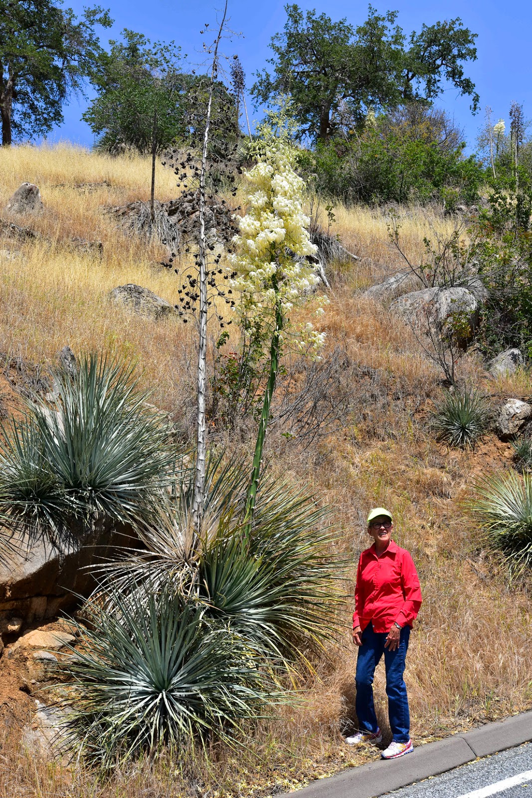
Kolob Canyon, Canyonland, Arches and Capitol Reef.  The state parks were in Texas:  Palo Duro, Utah:  Kodacrome Basin, Dead Horse, and Nevada:  Red Rock Canyon (BLM).  In Arizona there was Monument Valley and Antelope Canyon that belonged to the Navajo also a National Monument  called Canyon De Chelly (pronounce "can d shay") .  There were 13 states  that we rolled across.

To name a favorite is not possible.  Each park had its own special personality.   However, Jan like Palo Duro the best.   Something that kept going through my mind was how tough the settlers were that came across these areas.  Twice we followed rivers from their heads to full size.  The Virgin River started at the campground we stayed in Glendale, UT and we saw it cutting through some of the amazing rocks we saw on the whole trip (Utah, Arizona and Nevada) and the other river was the Colorado.  We followed the Colorado from the Grand Canyon through Canyonlands NP and into the Rocky Mountains.

Our desire to rush home was never an issue.  If fact, it wasn't until we left Colorado did the "Barn horse syndrome" hit.  There were no more scheduled places to see only the road home.  I'll have to say that knowing that  Nebraska was possibly a wind tunnel did not excite us.  However, the wind did not affect us there and instead we were very impressed with it.   When we drove across Missouri  we were looking at going through St. Louis at morning rush hour.  Our GPS, which had never lied to us on this trip, told us to take I-64 through the city.  Being rather skeptical, I had already planned another route.  The determining factor was going to be the traffic density at our turn off.  Traffic was light so, here we go through St. Louis.  THANK YOU GPS (it's a Garmin).

If for some reason the photo website became lost, I will give you the link again.    http://montes-capture-the-moment.smugmug.com/Travel/2015-Western-Trip/i-22FX3vW    Feedback on the photos would be appreciated (tell me your favorite pictures).
I hope you enjoyed the trip, we certainly did.
We are thinking Acadia next.

Monday, May 25, 2015

Colorado, first stop on the way home


Day 43    May 18, 2015

Morning in Moab
This is a beautiful day for travel.  As we awoke, we looked east to the La Sal Mountains as see the snow capped peaks and to the west the sun outlined the red rock edge of the Canyonland rim.  We hit the road by 6:30 for Loveland, CO. 
Looking East in Moab
As we drove through Moab, we wave by.  This is a great outdoorsy town.  Heading north to I-70 I notice that there was slight wind behind us.  This is not exactly what I wanted to see at this hour, knowing how winds build during the day.  Hitting I-70, I was surprised that the wind wasn’t really a factor.  Our first scheduled stop is to be Grand Junction, CO for fuel.  After about 45 miles we are driving along the side of the Colorado River and we will follow it all the way to mountains in Colorado.  The Grand Junction valley is beautiful and so clean and green looking compared to the deserts of Utah and California that we just left.  Just after Grand Junction we began the climb that would take us through the Rockies.  Our first climb is to Vail Pass, 10,662’.  Our RV really struggled to climb this “hill”. 
Vail Pass
We actually had our speed drop to 30 mph and it really wasn’t wanting anymore of this climbing.  At the top of Vail Pass we stopped for lunch at a snow covered rest area.  Getting back on the road, believing that we had finished our climbing, we begin a nice little decent.  That didn’t last long because we were starting up to the Loveland Pass.  This ascent was not a steep as before but, still the RV struggles in the thinning air.  Again we have our speed drop to 30 mph and finally we reach the top which wasn’t really the top but the Eisenhower Tunnel, elevation 11,990’.  Passing through the tunnel was a breeze even for a vehicle our size.  Exiting we notice a line of traffic on the oncoming side that extended about 2 miles down the mountain because of some construction at the tunnels entrance. 
Top of the Rockies
Yea, the climbing is over.  Descending toward Denver, we were met with an extremely dense fog with a visibility of less than a ¼ mile.   Since we go down mountains slowly, we ducked into the slow lane to avoid being rear ended.  Shortly, I came upon a tractor-trailer who was traveling about our speed so I tucked in behind him and let him lead the way.  About 10 miles west of Denver we broke out of the fog and from there we sailed to Loveland.  

Needles Hike?


Day 42    May 17, 2015

Drive to Needles
One last hike before we head home.  Today we drove to the “Needles” section of Canyonland.  This took about an hour and a half.  This is the lower district of Canyonland NP, thus it has to be accessed from another location.  Within this district are the “needles” and the confluence of the Green and Colorado Rivers.  Since we have seen “needles” in Bryce and we had seen pictures of the confluence, showing the colors of each river coming together, we decided to go to the confluence.  After some research we found out that this would be a nice hike along the tops of canyons to the overlook and it would be only 10 miles. 
Start of trail
I don’t know if I have mentioned but this trip has shown us that the National Parks are notoriously bad at distances.  We stopped by the visitor’s center to check out what we had learned before.  They told us there was a pretty good decent and climb out in our first quarter mile but after that it would be fairly easy.  That sounded good to us.  Well, we should have looked further on this trail.  Yes, the first quarter mile was tough climbing down then back up.  In fact, it took us nearly 45 minutes to do this.  If this were the only climbing then we would have been okay but, we found that it continued off and on for over 4 miles.  Some so bad that we had to crawl or scoot down and up 10-15’ rocks.  
Trail?
 
Slight climb (HA)
This nearly scared us to death several times.  Everything was ROCK and I don’t mean rocks with edges but with no features to grasp, just slip on.  At 4 miles we came to a slickrock that had a decent of 8’ to the ground (another rock) with no means of handholds or steps.  If we go down this rock we are committed but how will we return?  At this point we decided to turn around and keep our health.  Now all we have to do is get back without killing ourselves.  This is much easier said than done.  By being extremely careful and helping each other we were able to make it back without incident.  Neither of us had ever started a hike and not completed it before.   At this point, we realized that it is good that we are headed home tomorrow.  The only real regret that I have over this is that I did not get to make the picture of the confluence.  It would have been interesting to have seen the two colors together.

Trail?  Where?

Capitol Reef Excursion


Day 41    May 16, 2015

Rim of Canyonlands
We wake to rain and think so what.  Quickly we get moving and have breakfast at the “Jailhouse CafĂ©”, had to fuel up for the day.  From there, we hit the road for “Capitol Reef National Park”.  The drive to CR was over 150 miles, allowing us to drive away from the rain and into marvelous sunshine. 
Road to Capitol Reef
This is an upheaval in the middle of the state that blocks water from flowing in a natural direction.  In this park are some of the most outstanding canyons and rock formations we have seen. 
Bluffs of Capitol Reef
We seem to only have one word for each new sight we see, WOW”.   I know that I am not up on everything that the politically correct crowd uses but today I was reading one of our pamphlets and it said something about a timeline of 600 CE.  I had to find out what this means and they told me CE means current era as opposed to AD,  I promise, I won’t rant on.   As we drove back, we saw an extremely large thunderstorm, just to the side of I-70.   It was most impressive sitting on top of a mesa and spinning in a comma shape.  Back in Moab and the weather was back to being beautiful.

Sunday, May 24, 2015

Moab between campgrounds


Day 40   May 15, 2015

In the distant La Sal Mountains snow capped

Eastern Rim of Canyonlands
Because we were not able to pin a date down for our visit to Moab, we made our reservations only 2 ½ weeks ago.  Being this late, we weren’t able to get the number of days at our primary campground making us to have a secondary one.  So, today was our day to move.  I’ll have to say that our primary campground was extremely cramped but, its location was great.  After the move, we have lots of space even with the campground being full.  The view from our RV is spectacular.  Looking east we see the snow covered La Sal Mountains and to the west we see the Canyon Rim, with its jagged edges.  After getting situated, we drove up the Colorado River canyon on Highway 128. 
 
This is a narrow red rock lined canyon that goes on for nearly 40 miles.  It amazes me how this area is so “out of doors”.

Arches NP


Day 39    May 14, 2015


Climb to Delicate Arch
Today is to be our day at Arches National Park.  We started early but when we arrived at the park gates we had to join the line of vehicles entering the park.  Again, our first stop is the visitor’s center this allows us to find what the rangers think would be the best way for us to take in the park.  Since we knew we wanted to see as many arches as possible, we chose to go to “Delicate Arch” first.  This entailed a one mile and a half hike up from the floor of the park along a half mile climb up a “smooth” rock, that we did not want to be on if a storm came up.  By the way, the skies were threatening and we did encounter a few sprinkles coming down the trail.  The arch was quite pretty but being at the peak of a mountain, there was a lot of wind and this made for an uncomfortable condition. 
Delicate Arch
We were fortunate enough to climb up to the “Arch” with minimal competition, however, when we came back to the parking lot, there were 4 school buses loaded with 5th graders.   As we watched the children start up, the rain moved in.  I had already told the teachers of the students that I felt for them.  Now that they were on one of the most precarious trails, I really was concerned for them.  From Delicate Arch we drove back to the “Devils Garden” to hike and see several other arches.  It was raining fairly hard when we got there, so Jan told me to go on and see what I wanted.  I told her that I should be back in an hour to an hour and a half and off I went into the rain. 

Tunnel Arch 
Just about a quarter mile down the trail I came to a intersection that led to two different arches.  The first one was Tunnel Arch and the second was Pine Arch.  Pine Arch was a pretty arch with pine trees on each side of it, the rain had let up a little as I explored this arch with camera in hand.  From there I had intention of going to Double O Arch.  Heading that way the rain picked up again causing me to rethink my final destination.  On the way was an arch that I had always heard of and had seen pictures of, “Landscape Arch”.  In 1991, the arch had segment of it to fall from it.  This caused the park to change the way the trail went.  This arch is thought to be the largest arch span in the world. 
Landscape Arch
Seeing this and then seeing the trail that went on to Double O arch, I decided that I wasn’t ready to climb up another slick rock in the rain.   Delicate Arch was the most spectacular arch that I had seen.  Heading back, I met Jan about a half mile down the trail.  I got with her and took her to the arches I had seen.  We had intermittent rain as we returned to the vehicle for lunch.  We had to eliminate most of our wet clothes for some others that we carried with us.  Continuing to rain off and on we decided to go to some of the places we had skipped to coming out.  Most of these were locations we could see from the road or overlooks.  We went to one location called the “Windows” that had several arches
Windows Section of Archs
viewable from the parking lot, very nice (but lots of rain).  There is a section called “Park Avenue” that is very spectacular that we also saw as we headed back.  We are so fortunate that since only a few days a year there is rain out here, we got to experience it.  Sadly for us this may continue for the next 3-5 days.
Looking toward the "Courthouse" and "Park Avenue"

Dead Horse Canyon and Canyonlands


Day 38    May 13, 2015

Dead Horse Point
Carins marking the trail
Looking into the Colorado canyon
Mesa Arch
The plan today was to see Canyonlands National Park and Dead Horse Point State Park.  Again, another day began early for us.  We went to Dead Horse Point first and got there as they were opening.  Knowing there was going to be exercise during the day we decided at the Visitor’s center to hike out to the point and hike back.  First we looked off of the overlook at the center.  It was really impressive looking down about 1500’ and seeing dirt roads below that were used regularly for off-roading and mountain biking.  As we hiked on toward the point we followed “cairns” (stacked rocks) as trail guides to the location of the trail.  Most of the trail stayed between the road to the point and the bluffs.  The trail was fairly easy but over confidence slips up on us and Jan did a “face plant”.  She came out unscathed, luckily, always a concern for us.  When we arrive at the point, we joined several groups of folks that had driven.  What a view.  We were looking down on the Colorado River as it makes some great curves.  While we were there we watched a helicopter fly down into the canyon and up and down the river.  I was wishing that we could have been inside it.  That will not happen, since Jan doesn’t see any reason to leave solid ground for a better view.  After getting back to the visitor’s center we drove over to Canyonlands.  It was just a few miles across the plateau to it.  We stopped at the visitor’s center to get a plan for our visit. Our first stop was the Upheaval Dome.  The source of this has been a well debated.  As we look out in the crater with the broken dome we draw our own conclusions.  Most of us stand behind the idea that it was created by some type of falling extraterrestrial object.  We stop at Mesa Arch next and see one of the most photographed points within the park.  It really pretty looking through it and seeing buttes on the canyon floor.  More and more people are now arriving at the different lookouts and drive outs.  We headed next for the “Grand View Point Overlook”.  From this point we are able to see the canyons created by both the Green and Colorado rivers.   The hike to it was very easy along the edge of the bluff.  As easy as it was, I found a little rock that grabbed my toe and put me to the ground.  Since I was carrying a camera, I did not want it to hit the ground, so I tucked my left side into the fall and smacked the ground firmly, ouch.  I had a couple to see it happen and they rushed over to the old man and ask if they could help.  Joining them was a medic who wanted to make sure I was coherent, even walking up right that has been a debate among my friends for years.  He held up 3 fingers and asked me how many fingers, with a straight face I told him 4 ½ .  Then looking at him and making sure he knew I was not serious, I told him that I really was okay.  He insisted on seeing me get to my feet and me making my first steps.  I told him that I really did appreciate his concern but that I was okay.  He and the couple were really concerned and I did feel extremely appreciative of it.   The only thing that was actually hurt was my Garmin (broken) and all along my left arm were bruises and an elbow scrap.  Not bad given that over 210 lbs of me hit the ground hard. 
Canyonlands
Getting to the “Point” we looked out into the valley.  It is hard to describe what it looked like, but we compared it to a cookie cutter that created the first canyon and then a smaller cookie cutter cut out another set of cuts below.  This ain’t like any of the hills and valleys of Tennessee.  We thoroughly enjoyed our day at these two parks, they were a pleasant surprise.

Moab -- WOW


Day 37   May 12, 2015

Because we have heard from the weather forecasters that the wind will be picking up today we wanted to get an early start.  We did “good” by doing this. 
The only strong gusty wind we hit was about 5 miles from Moab.  Since the winds did not give us much of an issue, we were lucky enough to enjoy some beautiful scenery, as we climbed up and down some really tough “hills”.   The area along I-70 from I-15 to the Moab turn off was absolutely gorgeous.  At one point we read a sign that said that there will be no services available for 110 miles.  I thought that this wasn’t possible on an interstate highway at this time.  Boy was I wrong.  Through the some of the toughest hills that we have encountered, there wasn’t any help if we needed it.  In fact, as we came down one of the steepest and longest hills, the tractor trailer behind me hit a curb and blew a tire and destroyed a rim.  We heard the tire blow and weren’t sure it was or wasn’t us.  There was a pull over in a half mile or so that we pulled into to check out our RV.   The tractor pulled in also and that is when I saw what had happened to him.  We still were 30 miles from any service.  I asked if I could assist him in any way.  He said that his satellite system would take care of him.  So, I wished him good luck and hit the road.  Neither Jan nor I had ever been into Moab and we had no idea what to expect.  Driving the last 30 miles into Moab we experienced some spectacular red mountains on each side of the road. 
Then as we crossed the Colorado River the canyon opened into a magnificent valley and into Moab.  This is not a sleepy town at all.  Even though the streets are wide the traffic was heavy.   All along the main street there were restaurants, bike rental stores, 4-wheeler rentals and art galleries.  This is truly a town that caters to the active outdoor people.

Cedar City (backside of Zion)


Day 36   May 11, 2015

Kolob/Zion

Today we left Barstow for Cedar City, UT.  Thinking that we would have tough climb across the tip of Arizona in the Virgin River Canyon, again I dreaded it.   Since we had come through there on our way out there was already a memory of it.  Well, it wasn’t nearly as bad as I was afraid of.  There was a RV 5th wheeler that hustled and cut me off from going into the canyon first, thank goodness for this.  He ended up leading the line of traffic up the single lane of road construction.  He took the pressure off the rest of us from having to keep the speed up.  That was what I thought was the last long steep grade we would have before Cedar City.  Man-o-man was I wrong.  The roads were straight but the hills were long and steep, one right after the other.  Jan and I fell in love with the scenery as we travelled. The towns of St. George and Cedar City were beautiful clean towns.  In fact, when we reached our campground (KOA) , we found it to be the very nicest campground we have ever stayed in.  They were a nice reprieve from all of our California campgrounds that had dirt (dust) at their sites.  This KOA had concrete patios and gravel sites and grass borders and was extremely clean.
 
Kolob/Zion

Cedar City sits in a magnificent valley close to Zion and Bryce National Parks.  When we arrived, we found that Kolob/Zion, an extension of Zion, was just a short distance from our campground.  We hustled out, and drove over to go through the park. 
A new way to transverse wetlands
Being that it was on the back side of Zion, we saw lots of similarity to Zion with beautiful red rock walls. 

Barstow the first leg of the return


Day 35    May 10, 2015
Barstow Route 66

Heading toward Barstow.  After a very (yea) non-eventful trip we arrive at Barstow.  I had much worry during the night about the major “hill” between Bakersfield and Mojave.  We were able to top the hill with a minimum speed of 38 mph.  That wasn’t too bad based on the number of tractor-trailers we passed on the way up.  Around Mojave we saw acres and acres of windmills (power generators).   I really wonder how much power is generated by all of these.  We arrived earlier than planned and took advantage of it to go into town and explore.  This was quite a town in the days of Route 66, but today the town is not in too good of shape.  
One of many "dead" motels
Motel after motel are closed and left with a dismal look.  There is a small museum in the old railroad hotel dedicated to Route 66. 
Route 66 Museum
I was expecting to see things I had never seen being that it was from so long ago.  But everything looked like the items I grew up with.  There was a red 64 ½ Mustang convertible,
64 1/2 Mustang with no dents
just like the first car I ever dented.  There was a collection of cameras almost exactly like the one I have at home.  I left thinking that maybe I live in a museum.

Friday, May 8, 2015

Just missed the bad weather


Day 33   May 8, 2015

We haven’t been out on the road the last couple of days.   The weather has changed here like it has in so many places across the country.  The forecast for bad weather to hit this area was very accurate.  The forecasters predicted rain for our lower elevations and for areas above the 6000’ mark snow.  Today, the TV weather fellows told that there was a 20” snow in the area (Tuolumne Meadows)
Tuolumne Meadows before 20" of snow fell yesterday and today
that we visited on Tuesday.  They had a beautiful photo of the snow at the meadows.  The park had just opened the road Monday for the season.  Now the road is closed until further notice.  Also, the Glacier Point road was closed because of snow.  It is amazing that within 30 miles there was this much snow and none here in the foothills.

Thursday, May 7, 2015

Sequoia and Kings Canyon National Parks


Day 31   May 6, 2015


Big Sequoias
General Sherman(note small person at the base)

General Sherman
After spending our last day in Yosemite yesterday and the weather sounds like it will stop any travel above 6000’, we visited both Kings Canyon and Sequoia National Parks.  Taking a few minutes to study the map, we were off to Sequoia.  We drove down through the San Joaquin Valley where both sides of the road are covered with orange trees, cherry trees, grape vines, peach trees, olive trees, and many more types of vegetables and fruit.  Turning toward the mountains we began to see in the distance a faint outline of the mountains to come.  It didn’t take long on the curvy roads to get from 250’ above sea level to 4000’. 
Oversized Yucca Plant
As we drove along, we came upon some gigantic yucca plants. We stopped in the visitors’ center to get advice and then we were off.  I thought that the road getting to the visitors center was curvy.  Well it was nothing compared to the next 10 miles going to the Sequoias.   There was no question when we arrived at the Sequoia grove.  These trees are magnificent.  Most of the ones we saw were anywhere from 3’ in diameter to 18’.  We had to go to the world’s largest tree, the “General Sherman”.  It is over 2200 years old, 275’ tall (nearly the length of a football field) and the diameter is between 32’ and 36’ in diameter.  Sequoias are beautiful trees.  One thing we heard is that they are mostly fire resistant.  It is hard to find any Sequoia that hasn’t been in a forest fire.  Since there was a lot of traveling involved in our visits, we were short on time on our trip into King’s Canyon.  We were able to only get an overview of the canyon.  It was very impressive even at that.
Kings Canyon

Wednesday, May 6, 2015

Yosemite Valley and Tioga Road


Day 30   May 5, 2015
Upper and Lower Yosemite Falls


Bridalveil Falls
Since Jan and I had not visited Yosemite valley together, we went over for the day.  Our day started at a local restaurant for pancakes and French toast.  We had to have fuel, didn’t we?  The drive over brought us through the tunnel that overlooked the valley just a little after sunrise.   Since the sun rises from the far end of the valley the lighting on El Capitan was from behind it, the definition of it was not good.  We will have to return to this iconic location.  As we drove through the valley, we stopped at Bridalveil Falls for a short visit.  It amazes us how steep and solid the canyon walls are, then on down the valley and back to the visitor’s center.  On the way into the visitors’ center, we came upon the Ansel Adams gallery.   I think this might have been the first time I’ve ever seen some original photos by him, most I’ve seen have been copies.  He did an “acceptable” job printing the shots.  Another place we visited was the Ahwahnee Hotel. 
Ahwahnee Hotel
This is a beautiful hotel located at the base of one of the walls of the “Valley”.  Since we had heard of the Tuolumne Meadows and the Tioga Pass section of the park, we headed that way.  Monday, May 4 was the first day that this section of road had been open for the summer.  This road, mile for mile, is one of the most beautiful roads we have ever traveled.  There was overlook that allowed us to look at the backside of “Half Dome”.  One of the pictures shows people climbing the small dome before climbing the cable to the top of “Half Dome”. 
Backside of Half Dome--enlarge and look for climbers
Driving back into the valley before we headed home, we noticed that the afternoon light had changed the whole look.  So, as we drove up and out of the valley we came back to the “Tunnel View” site that we had started our day looking off.  It was a wonderful good bye to Yosemite.

Yosemite Valley as we left

Monday, May 4, 2015

Vernal and Nevada Falls Hike


Day 29    May 4, 2015

Nothing but optimism toward our hike
Monte at Nevada
As Jan said in her text this morning to me May the fourth be with you and it was today.  This was an extremely rare day today.  I went hiking without her.  We have had a running friend who lives in San Jose that came down to go hiking with me.  Since Jan had done so many tough hikes recently, she bowed out of going with us to hike up Vernal and Nevada Falls at Yosemite.  We have found that the parks maps and trail signs can’t be trusted here in Yosemite.  To show you what I mean, today’s hike according to the park newspaper was suppose to be round trip 3.6 miles and the trail signs totaled 6.8 miles but my Garmin totaled 8.8 miles.  This is the worst park I have ever been in for accurate distances. 
Vernal Falls
To Vernal Falls we had were nicely paved trails that climbed at 12 to 14%.  When we reached the bridge at the bottom of the falls there was a fairly large crowd.   From there we climbed the Mist trail to the top of Vernal.  Calling the trail Mist was very accurate.  I had to pull out one of my Kroger weather shields (plastic bag) to protect my camera. 
Mist Rainbow Vernal
At this point the trail was mostly granite steps.  This kept the steps from being very slick.  The fellow in front of me noted that each step was about 12” up and there were a lot of them in front of us to climb.  The falls were beautiful and I could easily see why someone would slip up and step into the pool above the falls to cool off.  It was extremely inviting.  From the top of Vernal there was a nice climb to Nevada Falls. 
Nevada Falls
 
Trail to Nevada Falls
Near the bottom of Nevada there was a beautiful place to look up toward the falls it was also a good place to take in a little water.  From there the trail turned away from the falls and through a forest setting before beginning a granite path to the top.  The granite trail was extremely interesting with its switchbacks and steps to the top.  Several folks were discussing going on the top of Half Dome.  For me that was not even a consideration. 
Nevada Falls
Climbing a granite rock hanging on to cables just didn’t excite me, never mind that the park said it would have taken another 10+ miles (give or take a few miles).  Since we decided to take a loop trail to return the trail was new to us.  It was a much better trail (mainly because it was downhill). This ended up being a terrific workout and hike.
Sure we would be happy to go further