Friday, May 1, 2015

Attempt to visit Yosemite Valley


Day 26    May 1, 2015


View from Glacier Point--Click to enlarge
Half Dome
We had intended to go into Yosemite today and drive throughout the park to see all of the beautiful sites.  Well we have found that every and I do mean every time we leave the RV to go somewhere we have to make several trips to the car and back, because we have forgotten something.  Today, after just two trips we were happy that was all it took.  About 10 miles down the road, not straight and flat but extremely curvy and uphill, Jan asked me did I set the thermostats to take care of the kitties.  
Lower falls is Vernal and the upper one is Nevada Falls
After one of those duh moments, I told her that I had not.  That wouldn’t have been so bad if the temperature wasn’t going to hit near 90.  I told her that we would make a quick trip and be back by 2:00 before the heat kicked in.  That sounded good to me but when we pulled into the parking lot of Glacier Point, however, when we got back to the car we both noted that the car was very warm.  As we drove to the “valley” I mentioned that we could make a quick trip from one end to the other and make a stop at the Visitor Center.  The closer we got to the bottom the more traffic we saw.  I thought that we could just make a quick trip to the vistor’s center and then hurry back to the RV.  That didn’t work, so we did a turn around and headed back, without any photos of the valley.  That was a real disappointment.  My experience driving in Tennessee on the hills allowed me to make the trip back a lot faster than we expected.  Normally, Jan would have protested at my speed but she probably closed her eyes as we hustled back.  When we got back the temperature in the RV was 92+ degrees, but the kitties were okay.  I look forward to the trip back into the valley.  What I saw of it was absolutely beautiful.

Yosemite Arrival---YEA!!!


Day 25   April 30, 2015

Today we made it to Coarsegold, CA a town just outside of Yosemite.  This will be our home for about 10 days.  From here we will cover Yosemite, Sequoia and Kings Canyon National Parks. 
When we arrived today we did a drive into Yosemite and visited the Mariposa Grove.  This is the largest grove of sequoia trees within the park.  Since we wanted to see these up close, we hiked the trail through the grove.  What beautiful trees, it is hard to imagine trees this large.  There were two trees within the grove that had been carved for people passage.  The largest is now fallen.  This tree was carved through in the 1800’s and was large enough to pass a horse drawn carriage through. 
Not so secret passage
The tree that is still standing has an opening through it of about 7’ by 6’.   Some of these trees are close to 25’ in diameter. 
Does this tree make me look fat?


Cabin in Sequoia grove
One tree could build several homes or make a lot of pallets (can’t get it out of my blood).  That reminds me of a pallet yard we stayed across the street from last night.  The building in front showed that it was a pallet company and a massage parlor. 
That is truly thinking outside the box when it comes to diversifying.

Wednesday, April 29, 2015

Southern California Travel Day


Day 24   April 29, 2015

Long Open Road
This has been a road day.  We left Pahrump, NV this morning for our road day to Bakersfield, CA.  For some reason, I am getting anxious each night before our travel days.  I think a lot of this is because I know there are a lot of “hills” that we have to cross and our RV does not have the kind of power I would like to match speeds with road tractors when climbing hills.  Another couple of things that create this feeling are that I have never been in these areas before and don’t know the roads.  We drove by Edwards AFB and the Mojave plane graveyard.   At first today, we drove nearly 110 miles and met less than 30 vehicles during that time. 
Desolate Desert (Mojave)
It was the most desolate area I think I’ve ever seen.  It had over 50 miles without any crossroads or services (of course no cell coverage).  One thing we noted today was that fuel prices went up overnight over $.20.  This is not great for our coming days of travel.

Monday, April 27, 2015

Red Rock Canyon at last


Day 22    April 27, 2015
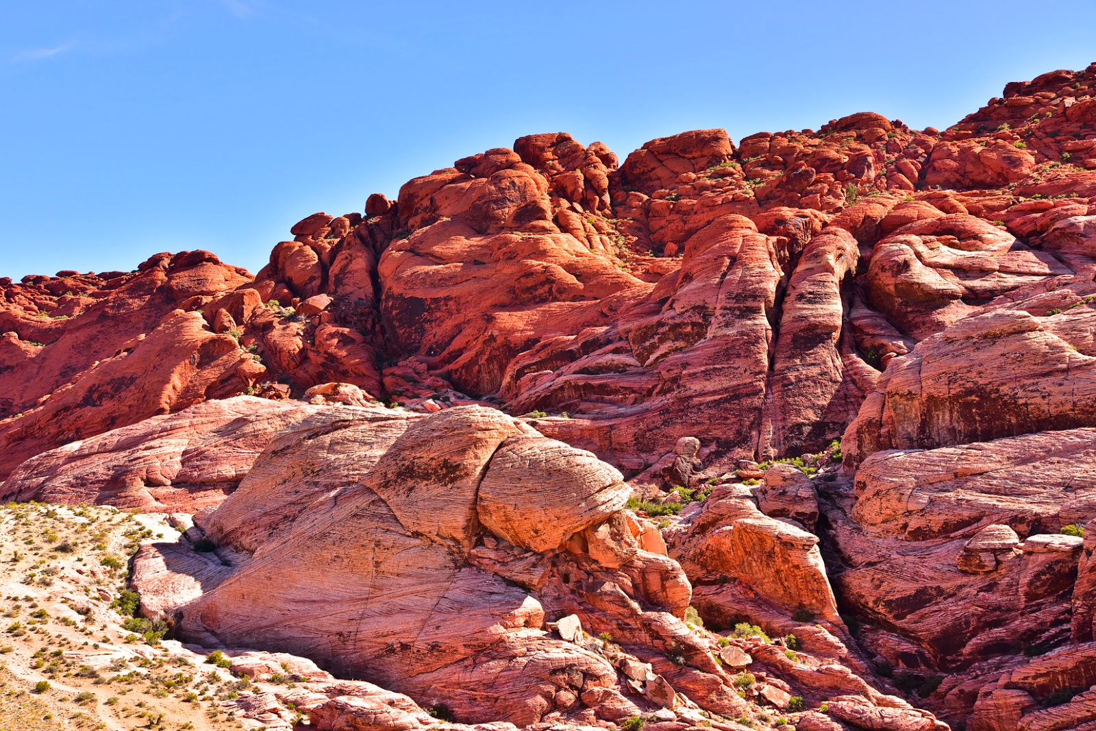
Over view of Red Rock Canyon

Red Rock Canyon at last.  For over 20 years Jan has wanted to see this canyon.  We were in Las Vegas 21 years ago for a meeting and at that time Jan and I had scheduled to see this canyon.  Jan got sick, thus keeping us from going to the canyon.  We have kidded about this for years and today we got to go.   We weren’t disappointed at all after all these years. 
Red Rock wall
When we arrived we checked in with the visitor’s center to find out about their hiking trails.  After choosing one we headed that way.  We tend to choose moderate difficulty trails for our new hiking adventures.  That is what we understood this one to be.  Well, it was a little more than that.  Climbing about 900’ wasn’t the issue as much as the footing nor was the 6.5 miles. 
The trail was mostly large loose rocks, making it rather precarious in footing and unstable for push off.  Still we “got ur done”.  Lots of others on the trail and some really interesting folks.  I had some great conversations. 
We had seen that there were wild horses and burros to look for.  We really looked hard but, not sightings.  Then on the road as we were leaving, BURROS!  One even thought that he would see if we would feed him.  That would be a NO, NO!

Death Valley Day


Day 21   April 26, 2015


Trail to Zabriskie Point
 
Early morning start so that we could go to Death Valley and go from one end to the other.  Our drive over was about 80 miles.  When we got to DV we learned that it was the largest of the National Parks and to drive from one end to the other was going to take a looong time.  The first stop was Zabriskie Point, what a beautiful place with several different colors and shapes of gullies and mud hills.


Zabriskie Point
 
On to the lowest point in the Western Hemisphere, Badwater Basin,
where the altitude is -282’ below sea level.  As we journeyed on to Furnace Creek we came across a fueling station that had some really expensive fuel, regular fuel $4.49/gallon.  As we drove up the park we came across the Sand Dunes.  Some of the dunes were over 100’ in height.  The park service recommended that as we walked across the dunes that we should be on the lookout for sidewinder rattlesnakes. 
We can happily tell you that we saw none.  However, we did see some beautiful sand formations.  One of our points that we wanted to see was  Scotty’s Castle.  On our way there we came across a 2000 year old volcano crater.  It measured just 600’  It really was an interesting structure.  From there on to Scotty’s Castle.  Scotty was cowboy con man who used his talents to entertain and con folks to fund his “goldmine”. 
There are so many long strait sections of highways out here that a person could easily drift off to sleep and if the car didn’t veer left or right could wake up in a minute or two and still be on the road.
2000 Year Old Volcano
deep and a half mile wide.
 

Saturday, April 25, 2015

To Pahrump, NV


Day 19   April 24, 2015

Today was vehicle check up day and laundry.  Luckily the afternoon was rainy and windy.  Thus, nothing of any consequence happened.  We did check weather for the next day or two.  This was not really encouraging; the weather predictions are for wind increasing and possibility of rain.   There was some question as to the route we should take.  Because of the possibility of snow above 8000’, we chose the most southern route, since it did not have that great of elevation.


Day 20   April 25, 2015

Backside of Zion
Early up and ready to go before day break.  Since our campground did not have good lighting, we waited on daybreak.  Our destination today was Pahrump, NV.  This is a town about 60 miles from Las Vegas toward Death Valley.  As we traveled were very happy that we had chosen the southern route. 
Rock Mountains
As we entered Nevada we began a 3500’ decent through some spectacular ROCK mountains.  The road was being worked on for several miles so we were forced into single lanes (that were extremely narrow). 
Single Narrow Lanes
Luckily there was no wind at this point.  However, just as we leveled out into the flat desert area east of Las Vegas, the winds began to pick up and continued for the rest of the day.  Passing through Las Vegas was eye opening to us.  We had been there about 20 years ago and driving through today we could tell that LV had grown considerably.  Leaving LV for Pahrump, we were looking forward to a nice simple drive.  Surprise, surprise.  There was a major mountain that we had to overcome.  This became the most difficult mountain that we had driven this trip.  Well, we made it.  Now we were in the desert of western Nevada.  What makes a desert a desert?  The lack of rain is the first thing.  The folks over here should be patting us on our backs.  We brought rain and not just a little shower but a gully washer for nearly 5 hours.  Tomorrow Death Valley.

Thursday, April 23, 2015

Utah's Scenic Highway 12


Day 18   April 23, 2015

The decision today was to recover from the climbs of the past two days by visiting one of the most scenic highways in the US.  This highway is Utah’s Scenic Byway 12.   The section we did was from Red Canyon (about 12 miles west of Bryce Canyon) to Boulder, UT.  This is a distance of about 82 miles.  There was hardly any mile of the trip that wasn’t unusual. 
Some areas were like Bryce with brightly colored spires, other areas were colored layer mountains, one area had an ancient “granary” built into the bluff (Pueblo Indians had built over 1000 years ago) and most impressive to us were the miles of “slickrock”  that make up all the terrain that surround the river.  I can’t imagine how the settlers of the 1870 began to cross these rocks.  Yet they did and built some beautiful communities in some of the river bottoms.  One area, about a mile long, was along a ridge with drop-offs on each side of the road of over 1000 feet. That stretch is called “The Hogsback.”
Hell's Backbone
It’s hard to put into words how vast the canyons were on each side of the road. The little town of Boulder was the last incorporated town in the 48 contiguous states to get regular motorized mail service.  Up until 1940, a mule delivered the mail on a road called “Hells Backbone”.  Note that there are no guard rails along this road and grades up to 14%.   This makes for some pretty good pucker factor as these are approached.   Weather was a major factor as to when the mail was received.